My Rachio 3 installation is on Fire Island which is a barrier island 1/2 hour south of Long Island in New York State. It is well known on the island that the weather forecast for the mainland can be, and usually is, very different, than we get on the island. While I enjoyed a two week holiday there, I definitely noticed that days that the WI+ said there would be rain, there was not and vice versa.
This has caused me to be very distrustful of the automated system so much so that I turned it off and now managed the watering manually. Of course, this is not the optimal solution but I do not know what is.
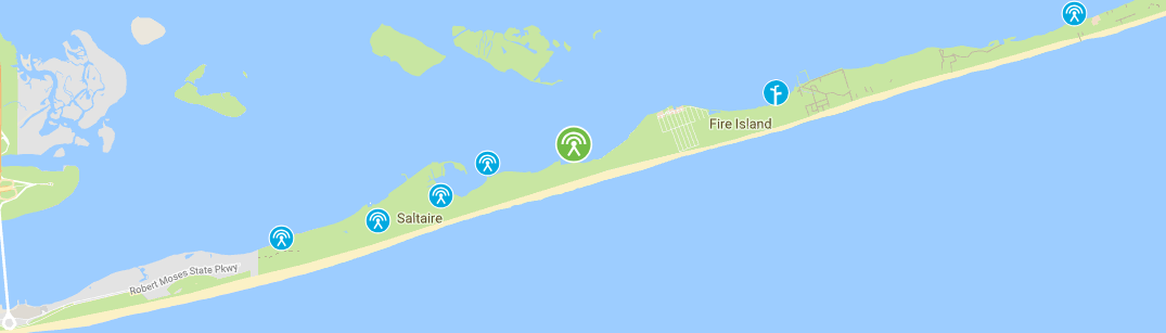
My recommendation is choosing a PWS on Fire Island. Had the team do a quick review and looks like you have quite a few options very close-by to your controller.
Interpolated weather data that you don’t have to worry about stations going down or not reporting precipitation which takes the burden off the homeowner of making sure they have an accurate reporting station. Interpolated data is great but won’t be exactly the measured amount that a PWS would give you near the house.
The ability to choose from over 250,000 PWS stations (Gen 1/2 has about 40,000 PWS stations). We are also wrapping up a WI plus feature that will self “heal” a chosen station, always making sure you are using one that is online, automatically choosing the next closest station.
I usually recommend choosing a PWS station if you have one that you feel that it is reporting accurate data. A chosen station will always be more accurate (and more timely) than interpolated data.
In an upcoming release we will default to a chosen PWS station and will also have weather station “self” healing as described above. Stay tuned.
As far as precipitation forecasting I can’t help much there. We use a leading edge weather service to provide that and it is an amalgamation of radar, national stations, satellites, and weather models.